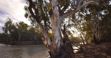
Murrumbidgee River at Darlington Point on 14 August. Photo: Murrumbidgee Council.
Minor flooding is occurring along the Murrumbidgee River at Darlington Point, according to a bulletin issued by the NSW State Emergency Services (SES) at 11:30 am on Monday (15 August). The river may reach a peak of 6.40 metres on Thursday (18 August).
Murrumbidgee Council mayor Cr Ruth McRae said, “the flooding is minor at this stage, but people should be mindful that water is moving downstream and remain vigilant”.
“Council has prepared the town as best we can.”
Murrumbidgee Council has been posting regular updates on their Facebook page.
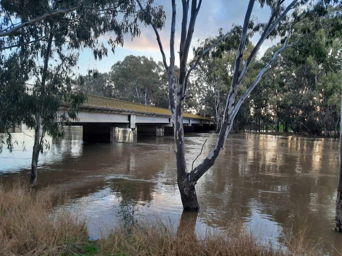
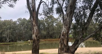
Photo: Murrumbidgee Council.
The SES have advised local farmers to move livestock and equipment away from flood-prone paddocks. It notes inundation of rural floodplains may occur and that water may impact the Sturt Highway at Tubbo (east of Darlington Point).
The unpowered camping area at the rear of Darlington Point Caravan Park has some water but the park is still open. The Darlington Point Boat Ramp, floating pontoon and access road are closed. Floodgates 2-6 have been closed and authorities have blocked the eastern drain to the creek at Darlington Point Caravan Park.
Cr McRae said she expects the Caravan Park to remain open.
The main flood peak along the Murrumbidgee River is now approaching Narrandera, where minor flooding is occurring. A moderate flood peak near 7.50 metres is possible overnight on Monday or on Tuesday.
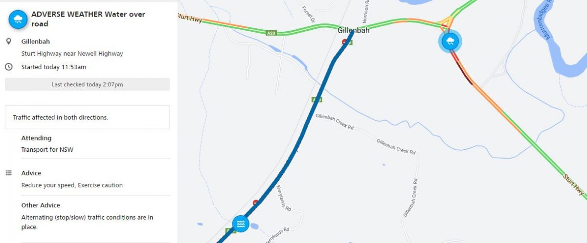
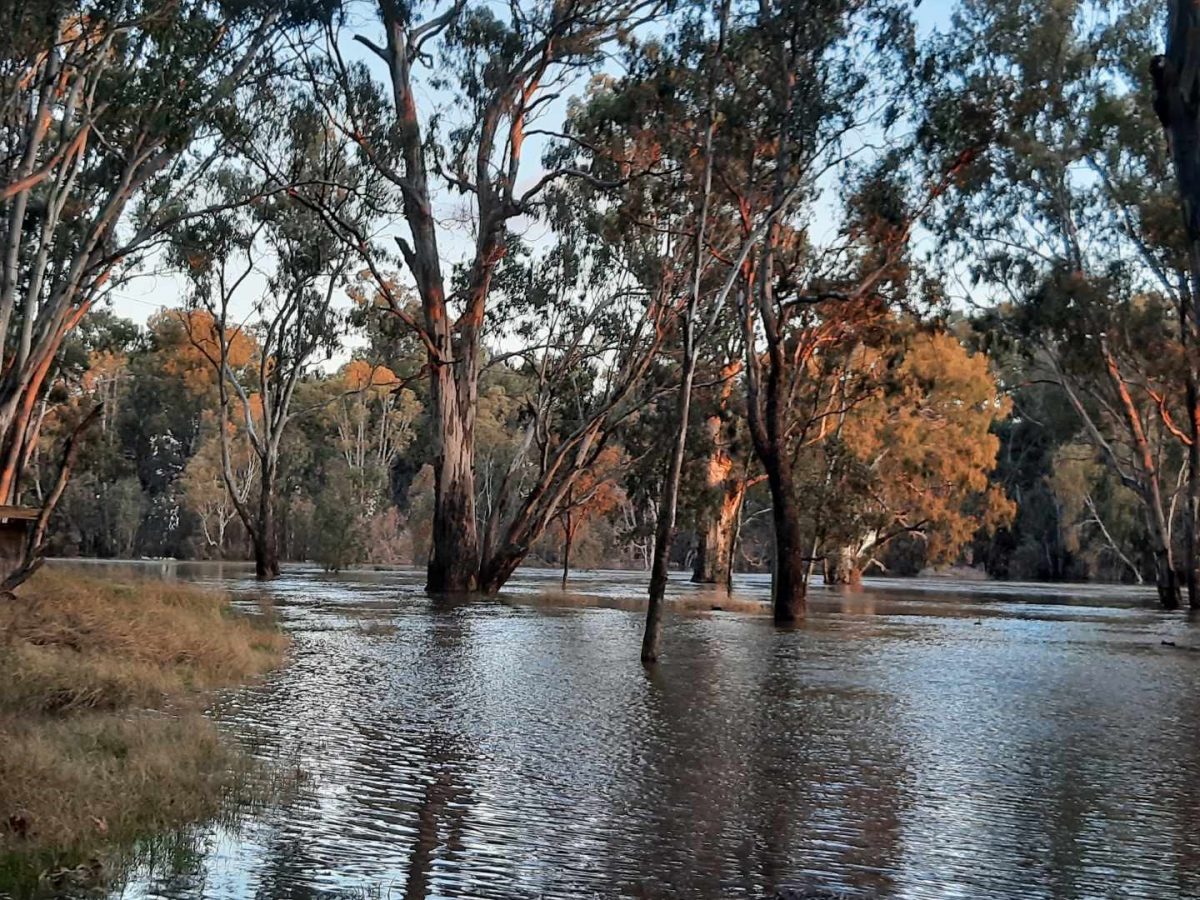
Water on the Sturt Highway. Photo: Narrandera Shire Council.
On Monday 15 August, Narrandera Shire Council advised the following roads are closed:
- Section of the Newell Highway between Kerrylands Road and Sturt Highway.
- Grong Grong River Road
- Buckingbong Road and Brewarrana Bridge
- Brewarrana Lane
- Town Beach entry
- Oakbank Street
- Brewery Flats Camping Grounds
- Woolscour Road
The Council also advises there is water over the road along the Sturt Highway near Gillenbah, coming into Narrandera from Wagga. Motorists are asked to slow down and drive with caution.
The SES states minor flooding is possible at Carrathool and Hay from Wednesday (17 August). Hay may reach moderate flooding by late August.