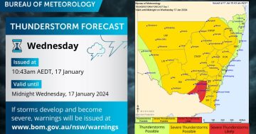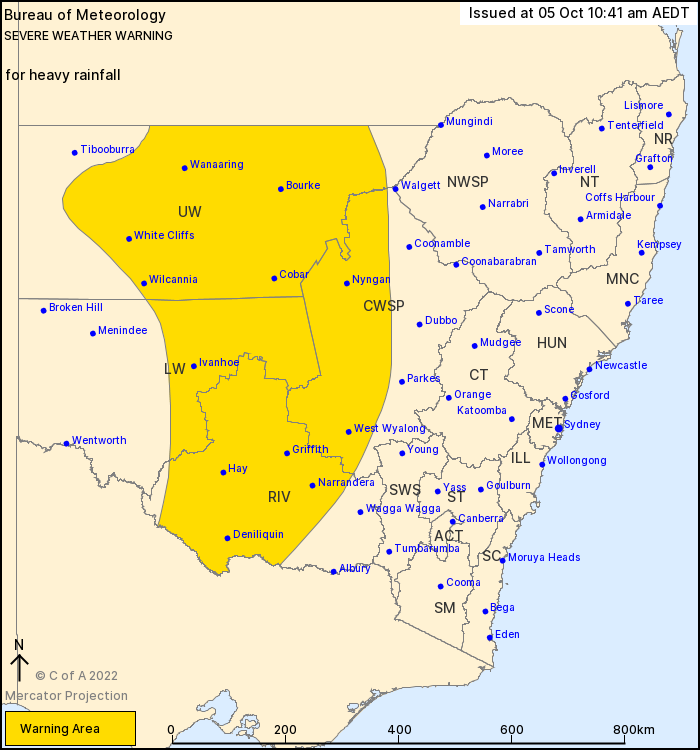
As at Wednesday morning, the shaded area was experiencing severe weather. Photo: Bureau of Meteorology.
The Bureau of Meteorology (BOM) issued a severe weather warning for the Riverina at 10:41 am on Wednesday 5 October, with a month’s worth of rain expected to hit the region over the next four days alone.
“Heavy rainfall which may lead to flash flooding has developed over parts of western NSW. The heavy rainfall risk will mainly be with clusters or bands of thunderstorms embedded in the rain band,” a BOM spokesperson said.
“A trough over central Australia is pulling large amounts of tropical moisture ahead of it over western NSW bringing a rain band and areas of thunderstorms, with associated heavy rainfall. The system will slowly move east during Wednesday.
“The heavy rainfall is expected to ease from the far west during Wednesday afternoon, then ease throughout the warning area on Wednesday night.
“Six-hourly rainfall totals of 30 to 40mm are likely, with localised falls up to 60mm possible. Twenty-four hour rainfall totals of 50 to 70mm are likely, with localised falls up to 100mm possible.”
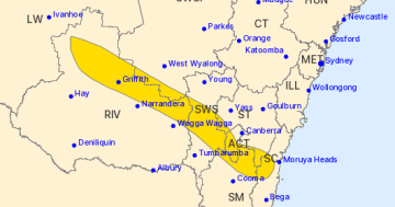
Heavy rain has been falling in much of the western part of the Riverina since the early hours of Wednesday morning. Rain is forecast to continue in Wagga until Sunday, but ease off in Griffith and Leeton by Saturday.

Sarah Armstrong shows her SparkDrop app. Photo: Oliver Jacques.
SparkDrop, a new app invented by Riverina mum Sarah Armstrong which allows users to post and compare rainfall levels, has seen a recent flurry of activity. A Merriwagga user posted 25mm of rain at their property at 9:26 am, while a Tabbita resident posted 15mm at their farm at 9:27 am.
“There is currently a flood watch in place for a number of rivers across the catchment, including the Upper Murray, the Murrumbidgee, the Tumut and the Lachlan River, so I would encourage people to check our website for the latest information,” NSW SES (State Emergency Service) Southern Zone Incident Controller Ben Pickup said.
As at noon on Wednesday 5 October, the Murrumbidgee River at Wagga Wagga was 6.29 metres and steady.
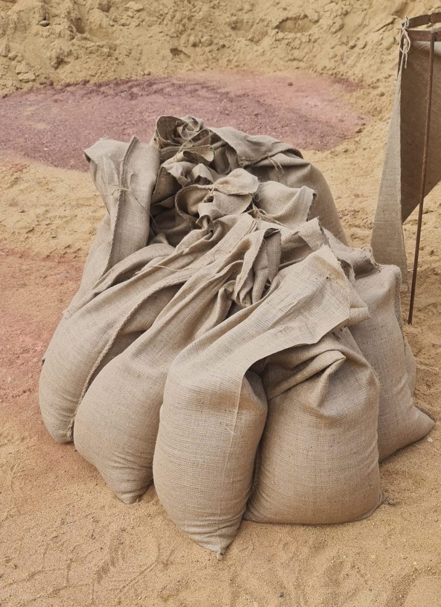
NSW SES Leeton Unit spent their Tuesday filling sandbags in preparation for what may come. If you’re a Leeton resident who requires sandbags or needs assistance, you can call 132 500.
Leeton’s SES are showing initiative. Photo: Facebook.
The NSW SES advises:
- You should not drive, ride or walk through flood water.
- Keep clear of creeks and storm drains.
- If you are trapped by flash flooding, seek refuge in the highest available place and ring 000 if you need rescue.
- Be aware that run-off from rainfall in fire affected areas may behave differently and be more rapid. It may also contain debris such as ash, soil, trees and rocks.
- Stay vigilant and monitor conditions. Note that the landscape may have changed following bushfires.
- For emergency help in floods and storms, ring your local SES Unit on 132 500.
For the latest information from the NSW SES, follow them on Facebook or on their website.
For the latest weather, warnings, rainfall and river heights go to the BOM website.
For the latest road closures go to the Live Traffic website or call 132 701.
For emergency help in floods and storms, call the NSW State Emergency Service on 132 500. In life-threatening situations, call triple zero (000) immediately.