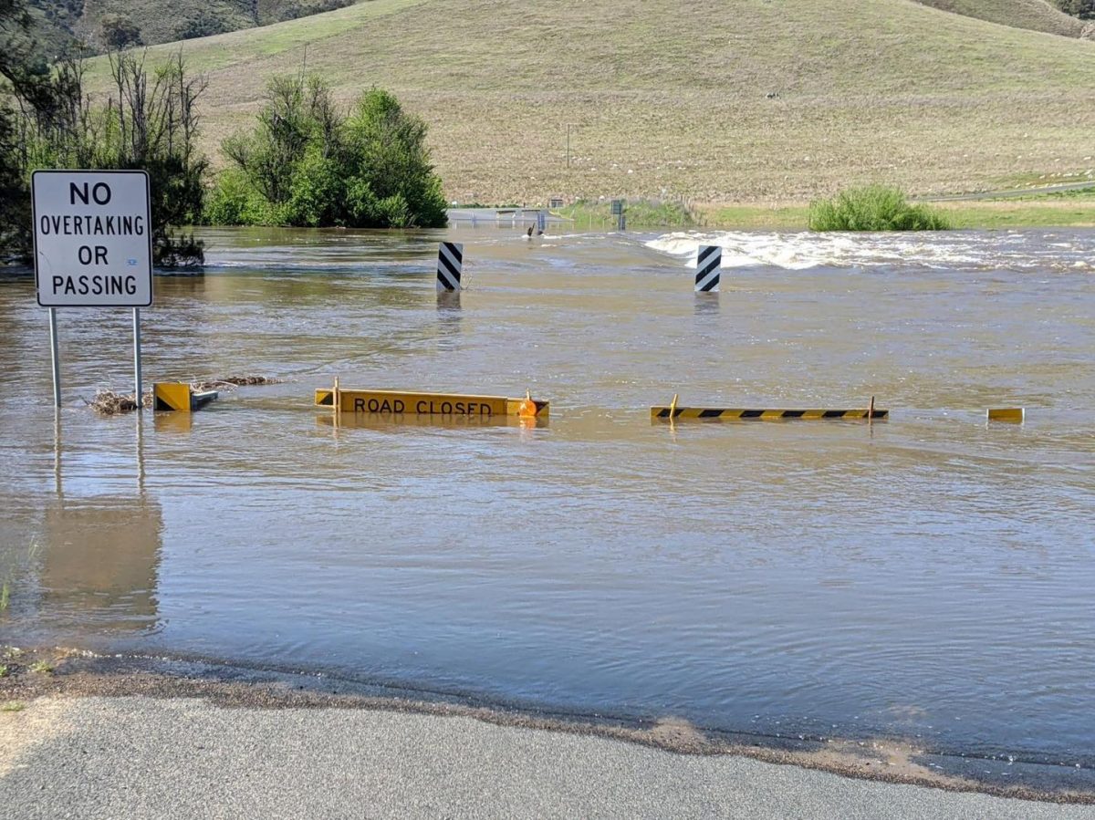
Gundagai’s Gobarralong Bridge as the water rises towards its peak on Tuesday morning. Photo: Peter Hilton.
“Stay away! It’s water – you saw it last month and it’s not like you’re going to see anything different!” warned State Emergency Service (SES) spokesperson Scott McLennan, urging the curious to avoid areas threatened by floodwaters.
“We know from experience that the road in and out of North Wagga is gonna get blocked with lots and lots of ‘rubberneckers’ going to have a look and see.
“If people can avoid travelling in the areas unnecessarily, that will make it easier for emergency services and the residents to come and go about their business.”
The Murrumbidgee is rising fast downstream from Gundagai, with real-time updates at Wagga showing an increase of about 4cm – 5cm each hour.
Despite several days of sunshine, the Bureau of Meteorology (BoM) is warning of another deluge and heavy rain moving north through Tasmania, Victoria and southern NSW.
For the second time in two months, Gundagai experienced major flooding as the river reached a peak of 9.04m – 2cm higher than the level in August.
In Wagga, the previous flood peaked at 8.74m, remaining below the predicted moderate flood level of 9m, but this time residents are bracing for the biggest river in a decade, with a peak of 9.2 or 9.3m on Wednesday morning.
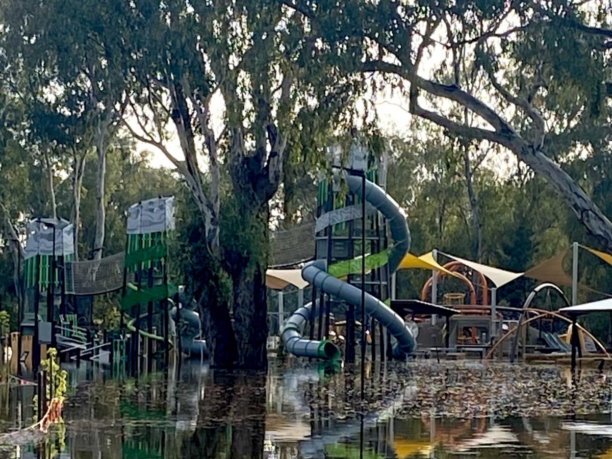
Wagga’s Riverside Precinct is underwater for the second time since opening in June. Photo: Chris Roe.
Preparations are well underway with parts of the city under a ”Watch and Act” warning, which is the second level of the new three-tiered system.
In practice, it means residents will keep a close eye on their own situation and prepare to be isolated by floodwater or to leave quickly if required.
Burrinjuck Dam remains at 106 per cent capacity with releases of between 80 and 100 gigalitres of water every day this week to try to create airspace and cope with the inflows.
Yesterday, inflows reached 100GL and the same volume was sent downstream.
“The dam releases have increased our consequences,” Mr McLennan said.
“We’ve been experiencing major flooding in Gundagai and moderate flooding in Wagga and we are expecting the peak to reach Wagga Wagga sometime on Wednesday.
“This obviously provides some low-lying areas around Wagga Wagga with a few challenges,” he added, indicating flooding across parts of Flowerdale, Mooring, Gumly Gumly and North Wagga.
“Last night, there was sandbagging opportunities over at the Wagga unit, and the cache at North Walker is accessible and we have volunteers there to help.”
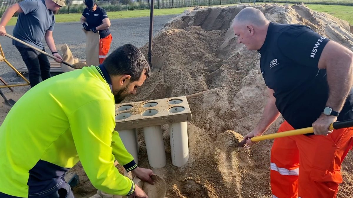
The Wagga SES has been preparing sandbags ahead of Wednesday’s river peak. Photo: Chris Roe.
You can stay up to date with the latest on the Murrumbidgee SES Facebook page here and you can keep an eye on the river heights here.
For emergency help in floods and storms, call the NSW SES on 132 500.
In life-threatening situations, call triple zero (000) immediately.