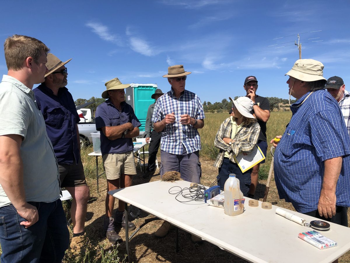
Allan Nicholson, principal salinity officer with the NSW DCCEEW Basin Salinity Program (centre), says filling the gap in groundwater data is an issue across the NSW Murray-Darling Basin. Photos: Supplied.
Dryland salinity is one of the worst land degradation issues in Australia, says West Hume Landcare project officer Rob Cook.
The group has just been announced as one of only nine recipients Australia-wide to secure significant funding through the Federal Government’s Climate-Smart Agriculture Program.
It will receive $376,000 to lead a new project addressing dryland salinity in the Eastern Murray Catchment.
With deep community roots and a legacy of salinity monitoring dating back to the late 1980s, West Hume Landcare is now poised to link decades of data with practical land management solutions.
“Our region is particularly at risk due to its underlying geology, topography, and climate,” Mr Cook said.
“We feel very grateful to receive support to continue our important work tackling salinity with our landholders and partners, and this is by far one of the biggest grants we have secured in recent years.”
The three-year project links land management, soil health and dryland salinity and is a collaborative initiative involving West Hume Landcare, Holbrook Landcare Network, Charles Sturt University, Murray Local Land Services and the NSW Department of Climate Change, Energy, the Environment and Water’s (DCCEEW) Basin Salinity Program.
“The project will combine research and on-ground monitoring to improve understanding of how land-use changes influence groundwater dynamics, salinity expression and the impact of salinity on soil health and productivity,” Mr Cook said.
“It will also look at practical land management actions that can mitigate salinity’s effects.”
Mr Cook said West Hume Landcare was uniquely positioned for the project, with one of the most extensive groundwater monitoring datasets in a non-irrigated region, dating back to the early 1990s.
Up to 30 landholders have been involved in smaller projects in previous years, with up to 90 piezometers in place (a piezometer is used to determine groundwater pressure/height, at a specific location).
“This data archive is a rare asset in dryland areas,” Mr Cook said.
“We are very unique in the data set that we have; there’s nowhere else in NSW that has such a good record of groundwater and salinity.
“It’s important that we now take the next step and link that data to the land-use change which has occurred and use it to help us understand how land management has actually impacted these things.
“Understanding the connection between land management and what’s happening below ground is key to reducing salinity impacts.”
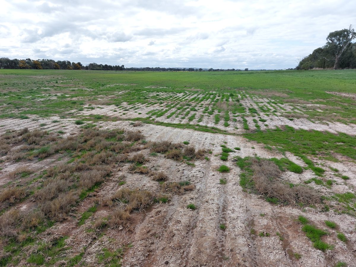
Dryland salinity reduces soil productivity, making it harder for farmers to grow crops or maintain healthy pastures. It also threatens biodiversity and water quality, forcing communities to invest in long-term landcare strategies and rethink traditional land-use practices to protect future generations.
Allan Nicholson, principal salinity officer with the NSW DCCEEW Basin Salinity Program, highlighted the importance of data collection in non-irrigated regions.
“Filling the gap in groundwater data is an issue across the NSW Murray-Darling Basin, as scant groundwater height and salinity information is being collected outside irrigation and production areas,” he said.
The geospatial research component, led by Associate Professor Ana Horta from Charles Sturt University, will focus on linking historical groundwater trends with land-use change, delivering insights into potential land management that can reduce the impact of salinity in the landscape.
Mr Cook said dryland salinity first sparked local action in the late 1980s, when salt scars prompted the formation of the West Hume Landcare group.
A major project ran through the ’90s and early 2000s, but interest waned during the drought as groundwater levels dropped and visible damage faded due to the extended drought.
In 2022, renewed community concern — especially after wet seasons reignited salinity issues —brought the project back to life.
“With nearly 35 years of grassroots involvement, including multi-generational landholders, we’re now moving beyond monitoring to trial solutions like pasture management and revegetation,” Mr Cook said.
”Demonstration sites are planned, building on past efforts and local knowledge.”