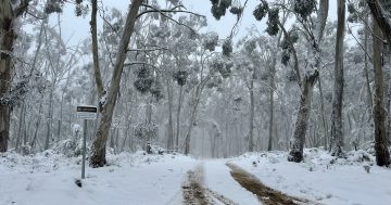
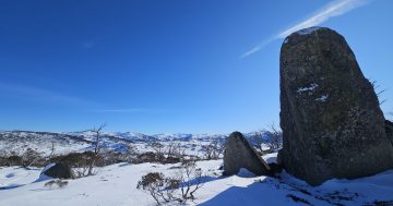
It’s snowing all the way down to the village at Thredbo. Photo: Thredbo Resort.
Snow lovers and ski bunnies are hopping as a dumping of powder has finally graced the Snowy Mountains.
The ski resorts started the month with an official snow depth of zero centimetres at Spencers Creek – the second time since records began in 1954 – but now the snow level’s dropped to about 1000 metres above sea level.
Perisher has already reported 20 cm of fresh snow overnight.
“It’s still snowing and blowing hard this morning! There’s likely more up top and with the wind, plenty of deep snow drifts around the mountain as well,” its snow report stated.
“It’s currently just over -1.6°C but feels like -10°C with the strong winds, which are blowing west-north-westerly at around 30km/h. We’re headed for a top of 0°C, and the weather will stay blizzardy all day.
“The snow guns have also been able to fire up this morning and will run at every opportunity to keep building on this natural snowfall.”
Thredbo is also celebrating with snow falling all the way down to the village, and 24 cm settling up high overnight.
Heavy snow is expected today (3 July).
“This will hopefully see snow settle in down to the lower slopes before the storm begins to clear up Saturday, with some models calling for storm totals of up to 35 cm,” Thredbo’s blog stated.
“Keep an eye on the cams and keep doing your snow dance … looks like it’s finally starting to work!”
Selwyn Snow Resort has announced it plans to open tomorrow (4 July) as snow has finally covered the runs.
“[There’s been] a steady snowfall overnight and we expect more to come during the day … plus it should get cold enough for the snowmakers to lend Mother Nature a helping hand,” it announced.
“With the new snow, it is looking more promising for some lifts to spin for the weekend, so stay tuned and keep an eye on our social feeds for updates.”
The snow’s arrived thanks to a polar air mass that’s finally made its way to the mainland.
June’s mild days, humid nights, and rain had left our ski resorts with no natural snow cover. It’s also made snowmaking incredibly difficult.
This weekend’s dumping is making everything look white, but the snowpack is still low for early July.
Another cold front is approaching, meaning it will remain blustery in the mountains today.
“There should still be significant moisture crossing the mountains in tandem with the cool air for a period of 36 hours or so from late on Thursday into the early hours of Sunday. This should generate the heaviest Australian snowfalls since the early June snow, which washed away,” a Weatherzone spokesperson stated.
“Perhaps the most positive news for Australia’s ski resorts as the school holidays get into full swing … is that the cold, mostly dry air in the wake of Friday’s cold front should produce ideal snowmaking conditions well into next week.”
Original Article published by Claire Fenwicke on Region Canberra.