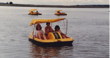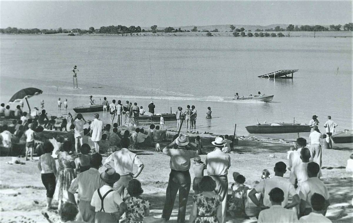
A water-skiing carnival at Lake Albert in the 1960s. Photo: Museum of the Riverina.
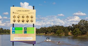
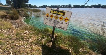
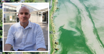
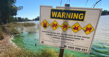
With the blue-green algae warning signs reinstalled at Lake Albert after a scorching start to 2026, we’re looking back at the early days when Wagga’s No. 1 waterhole was a popular, but even less reliable asset.
In the mid-1800s, the area around today’s Lake Albert was referred to as Swampy Plain, a name roughly translated from Wiradjuri in reference to its vegetation-filled wetlands that would occasionally dry up during years of drought.
But at the heart of Swampy Plain was an expansive waterhole that was popular with aspiring selectors and Wagga’s first winemakers.
Elizabeth Vincent moved from The Rock to Swampy Plain in the 1850s and established an impressive four hectares (10 acres) of vines and her own winery. She was soon followed by William Macleay, who set up the Wolonjerie Vineyard on the opposite, western shore of the lake.
By 1866, someone in authority had given the waterway a more salubrious name in honour of Queen Victoria’s late Prince Consort, but as Macleay’s newspaper, The Wagga Wagga Express, reported in August 1866, not all the locals were impressed.
“Swampy Plain as practical matter-of-fact people call that interesting selector’s paradise, or Lake Albert, as in official records it is more magniloquently dubbed,” the report scoffed.
In 1868, a correspondent from The Wagga Wagga Advertiser made the 6.4-kilometre trek to the Wolonjerie Vineyard and gushed about Lake Albert’s “great natural beauty”.
“Wooded hills enclose it on one side, while on the other a wide stretch of comparatively open country slopes gracefully to the water’s edge,” they wrote.
“The lake is about three miles round, generally free from snags, and in its quiet, placid beauty presents a marvelous contrast to the usual dry monotony of bush scenery.”
The reporter was duly impressed by Macleay’s 128 acres (51 hectares) and the two-year-old vines that were being overseen by a German man named Steiner, who had grown grapes on the Rhine.
“We believe it will be a great and unqualified success — the vineyard of the future so far at least as this district is concerned, and that it is destined to bring as much profit to the plucky proprietor as fame to the lovely lake …” they predicted.
In July that year, Lake Albert received a vice-regal visit when the NSW Governor, the fourth Earl of Belmore, was escorted to its “fair shores” by a delegation of Wagga dignitaries and a local cavalry troop decked out in garish crimson “garibaldian uniforms”.
In April 1870, a passing reporter from the Australian Town and Country Journal made mention of the “small surface-water lake” to Wagga’s east that was “surrounded by farms and vineyards, among which the most notable are Mr. Macleay’s and Mrs. Vincent’s”.
A small village began to take shape on the eastern side of the lake and both a post office and school were established over the next decade.
A public meeting was held in Wagga’s Town Hall during a drought in 1886 to answer calls to develop the lake into a more permanent water supply and an area for aquatic sports.
They considered a plan to create a diversion from Crooked and Stringybark creeks at an estimated cost of one thousand pounds.
In 1887, a “Travelling Correspondent” from the Albury Banner and Wodonga Express called in on the lake after the drought had broken to declare that it was no longer “a ghastly, parched-up cavity, surrounded by frowning hills”.
Instead, Lake Albert was once again a “lovely spot whose waters, nearly a mile long by half a mile wide, lay bathed in sunshine at your feet”.
“A large vineyard, with its myriad vines, occupies a portion of its banks, while a school, a church, and several small farms surround it on every side.”
Work on the Crooked Creek diversion eventually began in 1901, but heavy rains between 1916 and 1917 washed the bank away and the low-lying areas reverted to swamp lands once again.
It was not until the 1930s that a bank was built across Stringybark Creek, including a channel into the lake, a floodgate and a road bridge that raised Lake Albert Road to its present level.
The Crooked Creek diversion was reconstructed in 1946 and Swampy Plain’s transformation into a recreational artificial lake was all but complete.